Aerial City of Carbondale PA

Aerial City of Carbondale PA

Description:

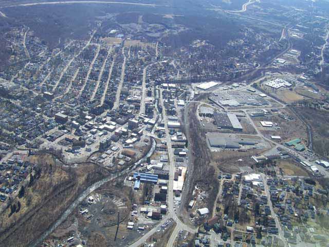
This is an aerial photo of the city of Carbondale PA. It was taken from about 2500' altitude. You can see remnants of the old Carbondale roundhouse as well as the other Carbondale landmarks. Main Street of carbondale is pretty much centered in the picture.

Posted by:

  • General
  • Aviation Magazines
  • Directory
  • Upload
  • Top Photos
  • Page 10
  • Page 20
  • Page 30

Contact Us | SiteMap | Privacy

There are currently 456 photos posted on the eye of the pilot network.

Copyright © 2024 --- eyeofthepilot.valmkt.com ---

We use both first and third-party cookies on this website. Cookies are small text files, stored on your computer that help provide advertising and give you the best experience while visitng our site. By continuing to use the site without changing settings, you are agreeing to our use of cookies. Read our complete cookie policy.